
Finding Records Along a Brick Township Street
For a named road in Brick Township, begin with one precise address rather than a broad name search. The county systems are parcel-centered. A street entry can lead to a property location and then to municipality, block, lot, qualifier, map, sale history, and deed book or page when those fields appear. Those identifiers travel better than a street spelling. They also help when a road name appears differently in an older document. Ownership shown in a parcel or deed record is a recorded connection, while a mailing address or a dated directory entry remains a separate kind of evidence.
The following order keeps the address workflow focused on records that are actually keyed to an address. It also leaves room for a failed result. A missing online hit can mean that the name, historic address, or available index does not match, not that no record exists.
- Search the Ocean County Tax Board Tax List Search by property location. Save the municipality, block, lot, qualifier if shown, map, and deed reference.
- Open the county GIS map, locate the parcel, and compare its geometry with the street, tax map, nearby parcels, and municipal boundary.
- Use the recorded-document index with the legal identifiers or a known party. Check a deed's date, book or page, legal description, and linked documents.
- For a lawful voter-record need, request a narrowly scoped Street Alpha product from the Ocean County Board of Elections. The public registration check is not a street browser.
- For older address clues, ask the Ocean County Library or Ocean County Historical Society about telephone books, newspapers, yearbooks, and any verified reverse-directory volume.
Note: Keep a dated note of each source and field, because a parcel owner, tax mailing addressee, registrant, and former directory occupant can be different people.
Brick Township Street Directory Parcel Pivot
The Ocean County Tax Board search is the first structured stop for a Brick Township street search. It does not expose an owner-name field in the research capture. Instead, it accepts Municipality, Block, Lot, Qual, property class, and Property location. Use the location field for an address, then refine with legal parcel fields if the initial spelling does not resolve. Parcel cards can show assessment, building, mailing, sale, and deed-reference information, although fields vary by card.
| Municipality | Expected dropdown field. Select Brick for a municipal parcel search. |
|---|---|
| Block and lot | Optional legal parcel identifiers that make a repeated street name more precise. |
| Qual | Optional condominium or unit qualifier. |
| Property location | Optional text field for an address or street search. |
| Property class | Optional dropdown; the captured research did not expose its exact choices. |
| SR1A and MOD IV labels | Tabs for sales and label-related modes, not a substitute for the parcel search fields. |
The screenshot of the Tax Board search screen shows the address-oriented fields available before a result is selected.
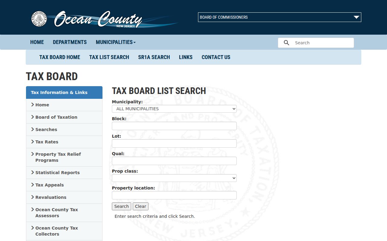
That field order is why the location search is a useful first pivot, while the resulting legal identifiers are the better handoff to maps and recorded documents.
Brick Township Streets in County GIS
Ocean County Planning's map page leads to the county GIS and ArcGIS Hub resources. GIS is the spatial part of an address search. It can add parcel shapes, tax-map orientation, aerial imagery, zoning, flood zones, wetlands, streams, easements, rights-of-way, subdivisions, and municipal boundaries. Those layers help distinguish two parcels on the same road from a parcel separated by water, a right-of-way, or an unbuildable strip.
Use the viewer's identify or select function when it is available, then record the parcel identifier before clicking adjacent parcels. The research did not verify the live control names, buffer tool, export behavior, or exact interaction sequence. If the map is difficult to operate, the practical fallback is to use the map for visual orientation and run each identified block and lot through the Tax Board search.
The county GIS maps landing page is pictured here as the starting point for a Brick Township street map search.
Use a GIS result as geographic context. The Tax Board and County Clerk remain the sources for the parcel and recorded-document fields behind a street-level conclusion.
Brick Township Street Records by Address
Several record systems can be connected to a Brick Township street, but each answers a different question. The Tax Board and GIS describe parcels. The County Clerk index follows recorded parties and legal documents. The Board of Elections can produce a requested Street Alpha registration file through its formal process. Brick building and code offices can be asked for existing releasable records, yet neither public page exposed a general result search. Historical sources may identify an older household only after a specific volume or newspaper item is verified.
| Address record | Brick Township connection | Record keeper | Access route |
|---|---|---|---|
| Tax list or parcel card | Location, block/lot, assessment, sale and mailing fields where shown | Ocean County Tax Board | Online search or counter |
| GIS parcel layer | Parcel geometry, adjacent lots, tax-map and physical layers | Ocean County Planning | Public map resources; viewer controls not fully captured |
| Recorded documents | Parties, document dates, legal fields, book/page, linked records | Ocean County Clerk | Online index from April 1, 1977; older work through offices or historical repositories |
| Street Alpha voter output | Requested registration output for a street and district | Ocean County Board of Elections | Signed OPRA request, format and use restrictions |
| Permit files | Work, dates, applicant or owner fields when releasable | Brick Division of Inspections | Office or OPRA; no public result interface located |
| Code records | Notices or summonses by address when releasable | Brick Code Enforcement | Office or OPRA; no public case lookup located |
| Older local sources | Address, household, notice, or family clues | Library and historical society | Catalog, branch, or on-site inquiry; exact Brick reverse runs unverified |
A street name alone is rarely enough. The strongest chain retains the property location and legal parcel data, then records the date and role shown for each party. That makes it possible to tell a current parcel field from a dated sale entry or an earlier newspaper mention.
Brick Township Street Directory Deed Trail
The Ocean County Official Records Search gives a Brick Township street search its recorded-document trail. The online index states coverage from April 1, 1977. Standard and Advanced Search include party names, second and additional parties, document type or group, dates, book and page, clerk file number, consideration, Legal Town/Lot/Block, maps, and linked documents. Start from a current grantee or legal parcel field, choose Deed where appropriate, and compare the detailed record before treating a party as connected to the address.
A grantor is the party conveying an interest. A grantee is the party receiving it. In a backward chain, the seller or grantor on one purchase deed becomes the next name to search as a prior grantee. Add date limits and spelling variants. A deed may also lead to mortgages, releases, easements, maps, or notices that explain why the same address returns several entries.
The recorded-document index is shown here with the interface used to begin that legal search.
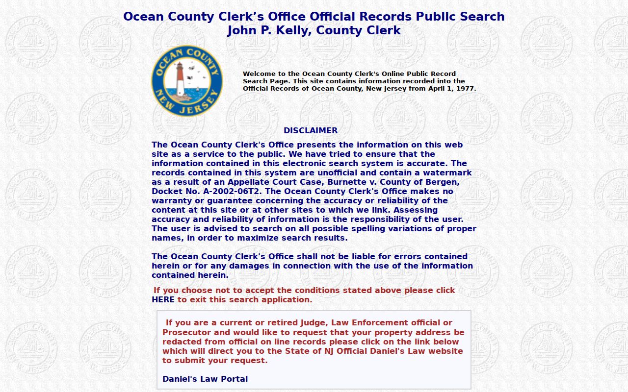
The index is unofficial and watermarked. Its search help advises spelling variants, describes automatic wildcard behavior for party names, and cautions users to check accuracy before relying on a result.
Note: The April 1, 1977 date is an online-index cutoff, not the beginning of Ocean County land records.
Brick Township Street Document Controls
The SearchApplication help page describes a result grid with one line for each indexed party and sortable columns. It identifies F2 for detail, F5 for an image, F3 for printing, and linked-document navigation. Images may require a one-time .NET or Crystal Reports component. These controls are useful for examining a confirmed record, but they do not turn a name match into proof that a person currently lives on a Brick Township street.
The official search help illustrates the standard and advanced options behind a more careful document search.
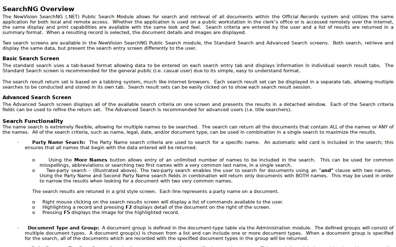
When the web index ends, take the legal description, party variants, and date range to the County Clerk, archives, historical society, or a qualified title search rather than guessing about an older deed book.
Brick Township Street Directory Voter Requests
New Jersey's registration check is identity-based. It is not a public, name-only, ZIP-wide, or street-wide map. The state guidance ties the check to date of birth and a New Jersey driver or non-driver ID, or the last four digits of Social Security number through its applicable path. Do not use it to browse a road.
The documented street route is the Ocean County Board of Elections information-request process. A signed OPRA request can specify municipality, district, Street Alpha output, optional phone field, party filter, and email, CD, or print delivery. The county lists no fee for email, $0.50 for a CD, and per-page print charges. The form states seven business days, while the county page describes seven to ten working days and possible election-cycle delays. The form also says that a valid mailing address is not guaranteed.
Registration output is a dated registration record, not a household roster or a record of how anyone voted. Preserve its stated field, active or inactive status, district scope, and restrictions.
Brick Township Street Address Fields
An address search becomes more reliable when six values stay separate: the entered street address, situs or location, tax mailing address, municipality, ZIP or postal label, and block/lot/qualifier. A parcel's situs is its physical location. A tax mailing address is where notices are sent and can be in another city, ZIP, or state. It is a useful lead, but it does not prove that the addressee lives at the parcel.
- Parcel
- A defined piece of land in the tax and map system, usually identified by legal fields such as block and lot.
- Situs address
- The physical location of the parcel, sometimes labeled location on a tax card.
- Plat or tax map
- A map showing parcel or subdivision context; it does not replace the legal description in a deed or survey.
- Criss-cross directory
- An address-to-occupant directory for its publication year. No Brick title or year run was verified in the research.
County GIS and Tax Board municipality fields are the best way to test governmental geography. A Brick postal label is not, by itself, a municipal-boundary finding.
Brick Township Street Permit Records
Brick's Division of Inspections handles construction, alteration, repair, removal, and inspection work. No public permit-result search was found. For existing releasable records, make a focused request with the address, block and lot, date span, and record type. Inspection scheduling uses an account-based portal, so it should not be treated as a public address reference.
Code Enforcement also has an address connection through reports and coordination with zoning, construction, and property maintenance. The department lists an anonymous reporting route, but its public page did not expose a searchable case database. The practical fallback is the office, the township archive, or a specific OPRA request for releasable records. An address report is not proof of a resident or an occupancy list.
Brick Township Street Postal Boundaries
Postal labels are a common Brick Township street-directory trap. The USPS routing-label record recognizes 08723 and 08724 as primary Brick labels and lists alternate Brick routing labels, but a routing label does not draw the township line. The county Tax Board's Municipality field and GIS municipal-boundary layer answer the governmental question. The legal municipality, block, and lot in a recorded deed are stronger than an assumed city name.
For streets near waterways or neighborhood edges, preserve the postal label, municipal label, and legal parcel field exactly as each source gives it. The ZIP page explains the label evidence in more detail, while the Brick Township ZIP code directory is the right place to compare postal labels before narrowing a search to a street.
Limits of a Brick Township Street Directory
An address-based records trail can show parcel and document connections, but it cannot supply a complete list of everyone in a home. Non-owner occupants, household members, utility customers, delivery records, and motor-vehicle addresses are not ordinary public street-search sources. Recent or restricted vital records, sealed or expunged court material, and protected address records also remain outside a normal address lookup.
New Jersey's Address Confidentiality Program can provide a substitute address to eligible participants, and Daniel's Law can remove home address and unpublished phone information for covered people. Do not attempt to rebuild a protected address from other records. For a legitimate correction, release, or access question, contact the custodian directly under the New Jersey Open Public Records Act rules.
Lawful use. Use Brick Township street records for lawful personal, family-history, property, or civic research only. Do not use records to stalk, harass, threaten, or harm another person.
Note: Confirm a record with the County Clerk, Tax Board, Board of Elections, or Brick office before making a decision based on it.